Weekend Surf Forecast: July 25-26, 2026
Here's the honest read for the weekend of July 25-26, 2026, region by region, straight from our 50-meter SWAN nearshore model — the resolution that resolves what actually stands up at the sandbar, not what a coarse global grid or a single offshore buoy averages out.
I'll be upfront: this is a small weekend for most of the U.S. coastline. One region is worth setting an alarm for, and a lot of coast is sitting in the 1-2ft, short-period range that's more longboard-and-coffee than session-of-the-month. The bright spot is Southern California, where a Southern Hemisphere groundswell is filling the south-facing breaks — though even there, the size guidance has enough spread that I'd temper expectations rather than hype it. Everywhere else, we call it like it is below.
Southern California
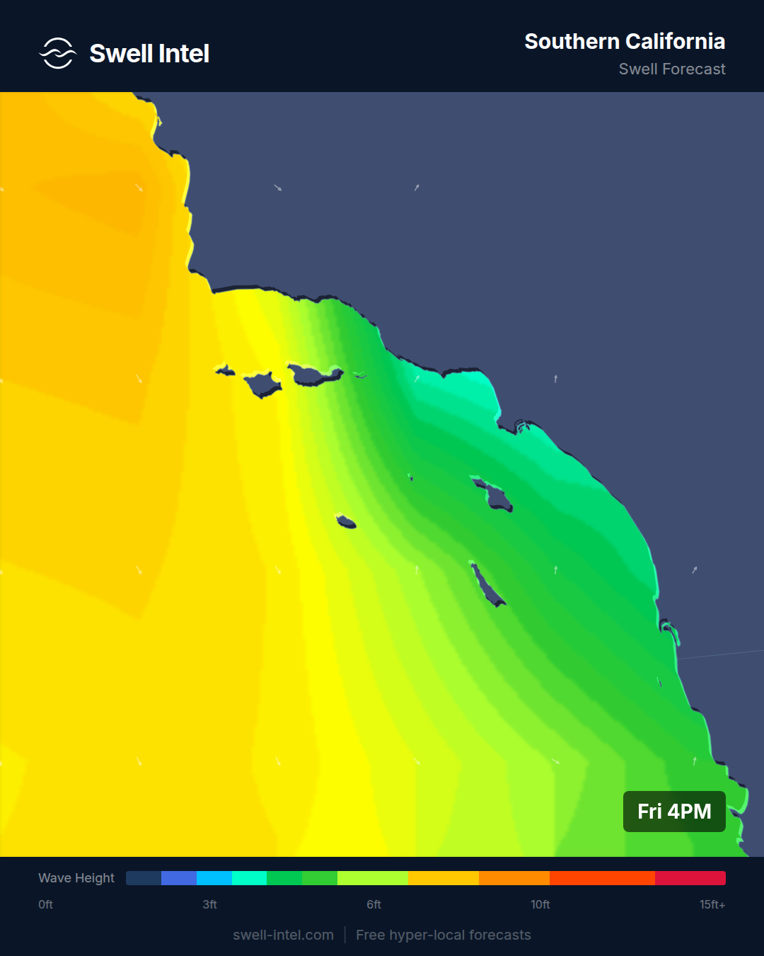
Surf: 3-4ft (sets to 5ft) • Best day: Sunday, AM • Conditions: Good
This is the one to watch. Our model has a long-period south swell — 12.5 seconds out of roughly 185-190°, a textbook Southern Hemisphere groundswell — filling the south-facing breaks through the weekend and peaking Sunday. Trestles and Malibu's First Point are the standouts, with our model calling sets to head-high (5ft) on the cleaner points. Cardiff Reef and Huntington Pier sit a notch behind around chest-high (4ft), and El Porto lags at 3ft and Poor-Fair — it's more exposed and doesn't hold the south angle as cleanly as the points do.
The reason those points light up is the swell angle. Trestles, Malibu, Cardiff and Huntington all face S/SW, so a swell out of 185-190° walks straight into the cobblestone points and wraps cleanly down the line. The 12.5-second period is the number that matters: it's long enough to push real energy through and refract around the Channel Islands, which is why the south-facing points come alive while the beach breaks stay softer. Timing-wise, get it early — our model favors the Sunday morning window before the afternoon sea breeze puts texture on it. Classic summer SoCal: dawn glass, then it backs off.
One honesty caveat, because I'd rather you under-promise and get surprised upward. There's meaningful spread in the guidance on how much of this long-period energy actually stands up at the sand — our nearshore call is on the bullish side, and the broader signal isn't unanimous. So I'd lean conservative: plan for waist-to-chest with better sets rather than banking on solid head-high, and check the buoys at dawn patrol before you commit. Long-period south swells can be slow to fill on the first morning if the period is still climbing.
Best bets: Trestles or Malibu First Point, Sunday morning in the offshore window — with size expectations dialed to the conservative end.
Northern California
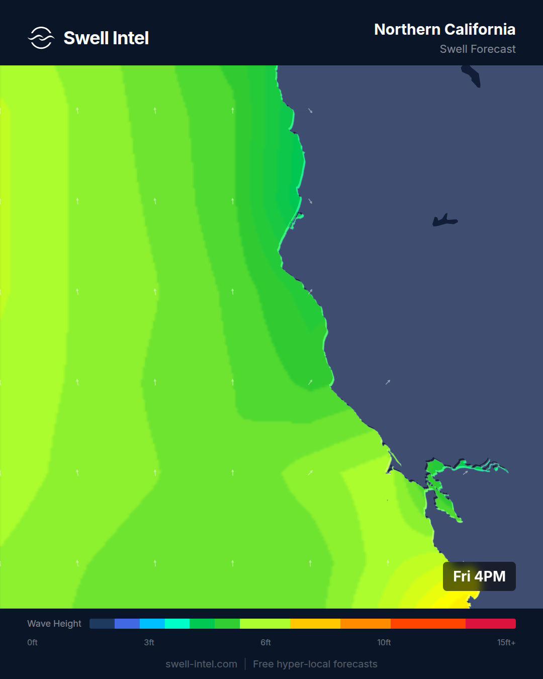
Surf: ~2ft • Best day: Sunday, AM • Conditions: Poor-Fair
It's small and mixed up north. Ocean Beach in San Francisco is the pick at maybe waist-high, working a leftover piece of the same south swell SoCal is getting — 9.8 seconds out of 186° — but it arrives far weaker this far north, since OB faces W/NW and only catches that south energy at a glancing angle. Linda Mar in Pacifica is running on a weak 5-second WNW windswell (296°) at 2ft and Poor, which is essentially wind-chop rather than groundswell.
This isn't a weekend to make the drive for NorCal. Best case is a small, soft Ocean Beach morning on Sunday before the wind gets on it. Best bets: Ocean Beach on the Sunday dawn check if you're local — otherwise it's one for the longboard, not the road trip.
Pacific Northwest
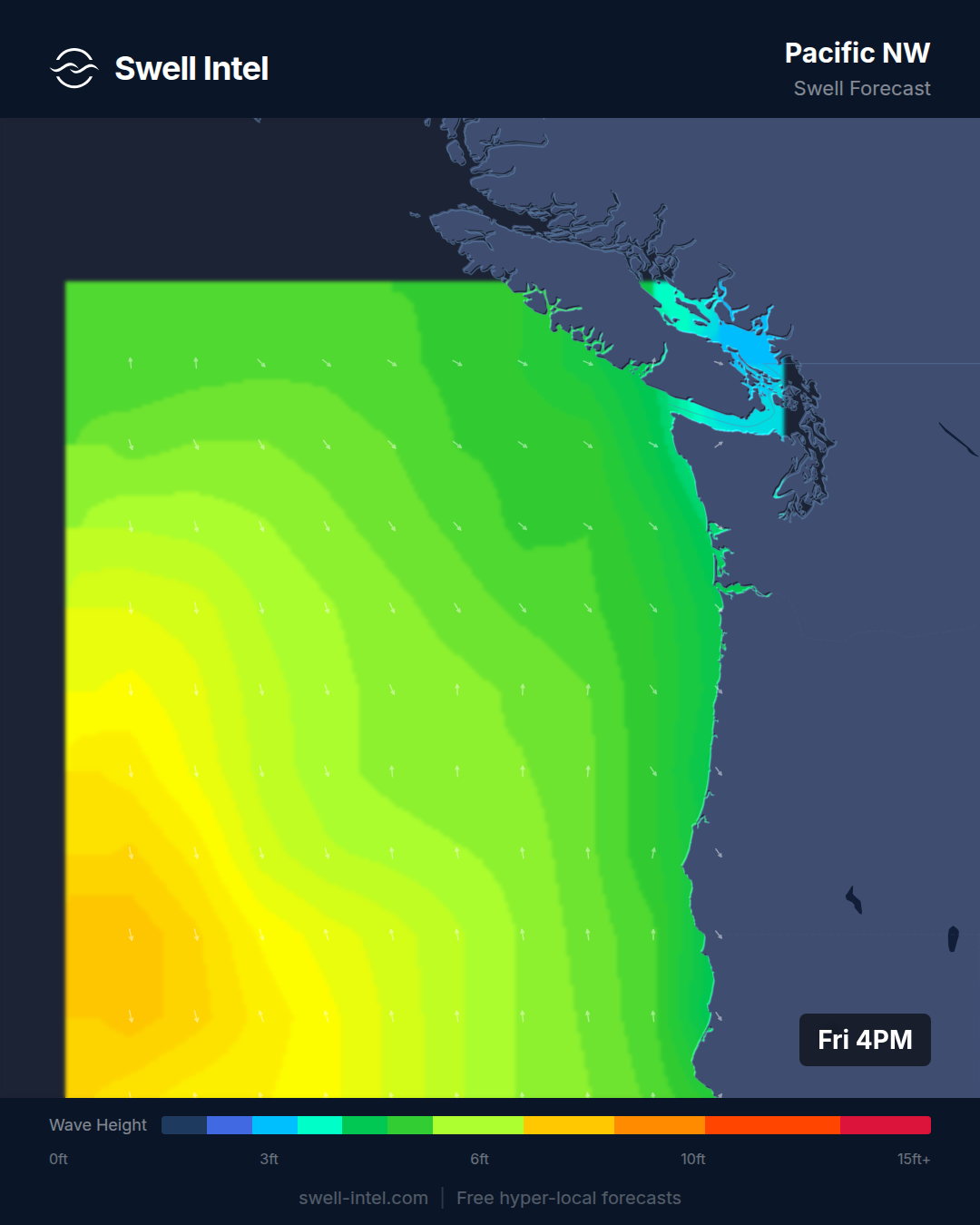
Surf: 2-3ft • Best day: Sunday, AM • Conditions: Poor-Fair
Oregon and Washington have a modest NW windswell in the water — 8.6 to 8.9 seconds out of 303-316° — putting Cape Kiwanda, Indian Beach and La Push around 3ft, with Seaside Cove a bit smaller at 2ft. That 8-9 second period tells the story: this is short-interval windswell, not a clean, organized groundswell, so it'll ride on the weaker, mushier side. Ratings are Poor to Poor-Fair up and down the coast.
Morning is your only real window — our model has the AM slightly favored before conditions soften through midday, and up here wind is always the deciding factor. If it stays light early, the NW-facing spots will give you a rideable-but-average session; if it doesn't, there's not enough swell period to punch through the chop. Best bets: Cape Kiwanda or Indian Beach, Sunday morning, if the wind cooperates. Nothing here to rearrange your weekend for.
New England
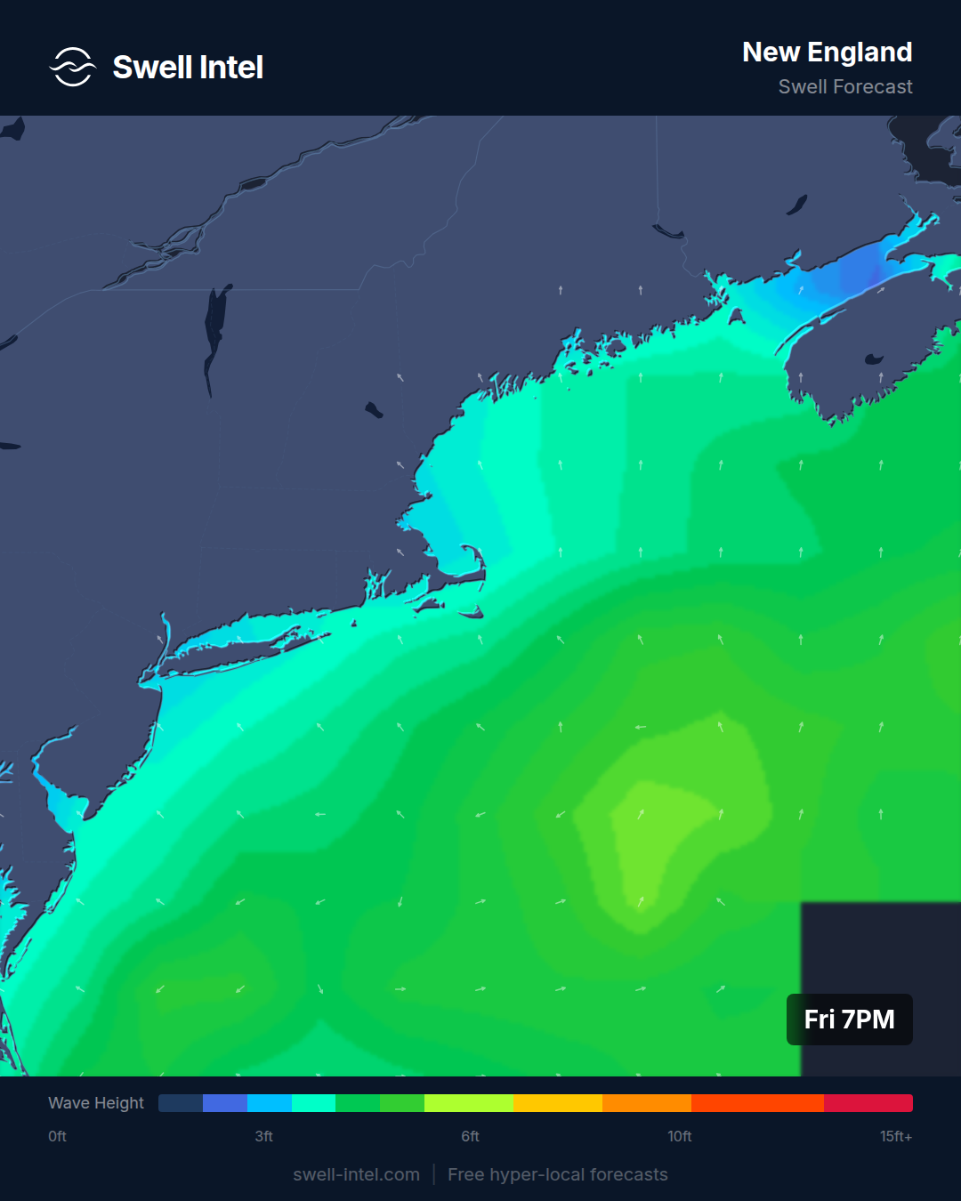
Surf: 1-2ft • Best day: Saturday, AM • Conditions: Poor-Fair
Small and soft across the Northeast. Rhode Island's south-facing beaches — Narragansett and Misquamicut — are picking up a weak 7-second S/SSE swell (165-175°) at around 2ft, while New Hampshire and Massachusetts (Hampton, Nantasket) get an even shorter ESE windswell (104-120°, roughly 6.7 seconds) at the same modest size. Everything is Poor-Fair; there's no real push behind any of it.
Saturday morning is the pick — our model rates the AM window best before it drops off through the day. It's a longboard-and-coffee weekend up here. If you're getting wet, Rhode Island in the Saturday dawn window is the play, since the S/SSE angle favors those south-facing beaches over the ESE-exposed spots up in NH/MA. Best bets: Narragansett, Saturday morning.
New York / New Jersey
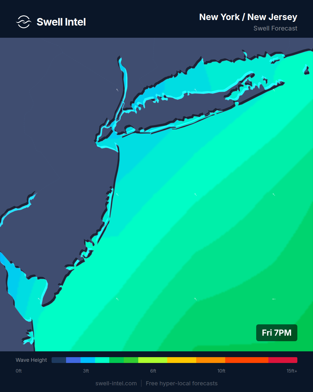
Surf: 1-2ft (spots to 3ft) • Best day: Sunday, AM • Conditions: Fair
This is the East Coast's best small-surf option this weekend. A short-period SE swell (6.2-6.4 seconds, 139-151°) has Manasquan up to 3ft and rated Fair — the standout of the entire Eastern Seaboard right now — with Rockaway and the other NJ beaches a touch smaller. These are beach breaks, so they live and die on sandbars and wind, and the SE angle should find the better-shaped bars.
It's still small and short-period, so keep the expectations calibrated — but the Sunday morning window (our best-rated slot) is a legitimately fun one for a beach break if you're local. The SE swell has just enough angle and size to stand up on the right sandbar before the sea breeze fills in. Best bets: Manasquan, Sunday morning.
Outer Banks
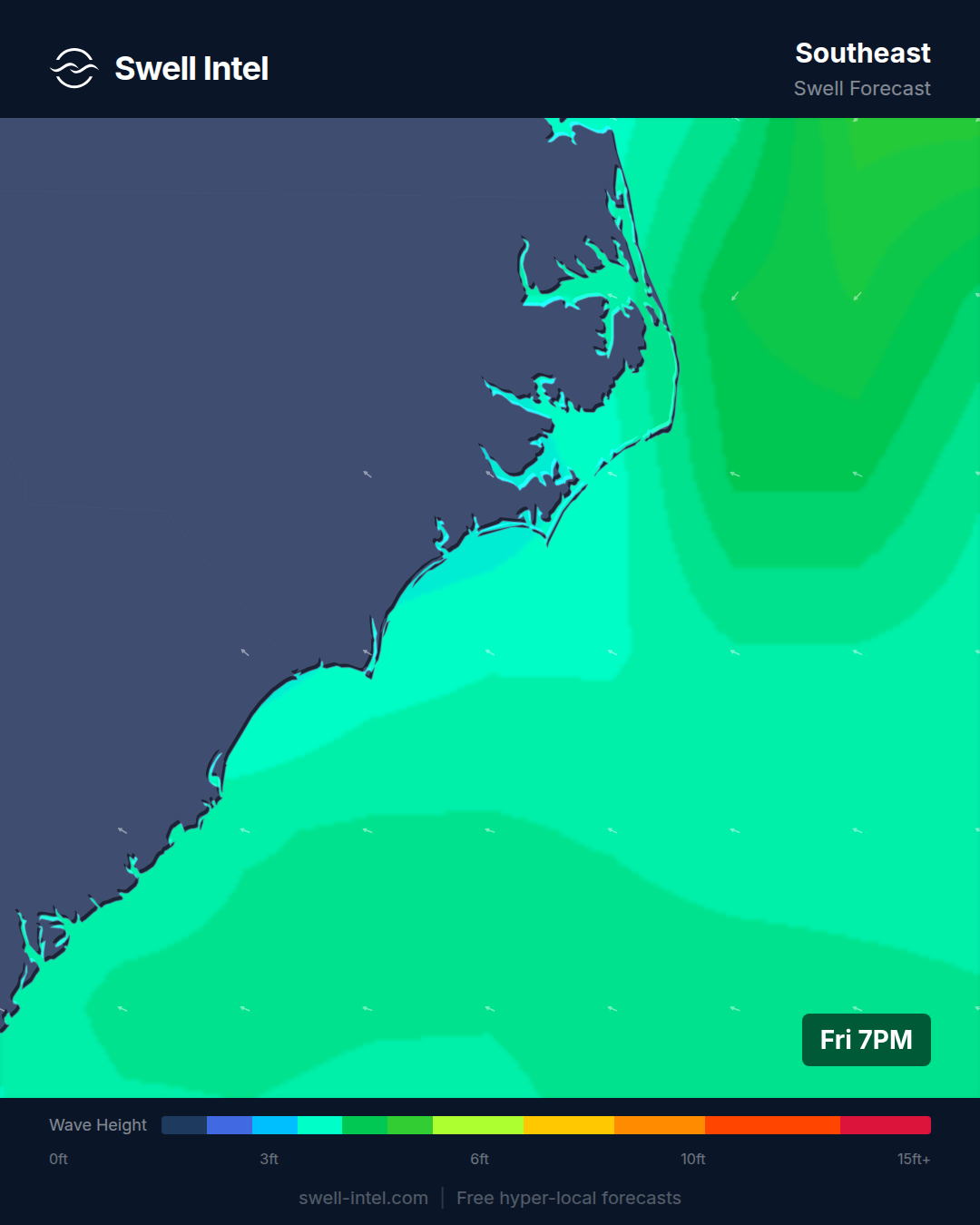
Surf: 1-2ft • Best day: Saturday, AM • Conditions: Poor-Fair
Hatteras and the Carolinas are quiet. An 8-second SE windswell (131-132°) has Cape Hatteras around 2ft and Poor-Fair, with Folly Beach a notch below at Poor. For a stretch of coast that usually acts as the East Coast's swell magnet — sitting far enough out in the Atlantic to grab everything — there's just not much in the water this weekend.
This isn't the Outer Banks doing what it does. Saturday morning is your only real shot at something rideable, and even that's marginal. I'd save the Hatteras run for the next NE groundswell or the first tropical pulse of hurricane season, which is right around the corner. Best bets: Cape Hatteras, Saturday morning, with low expectations.
Florida East Coast
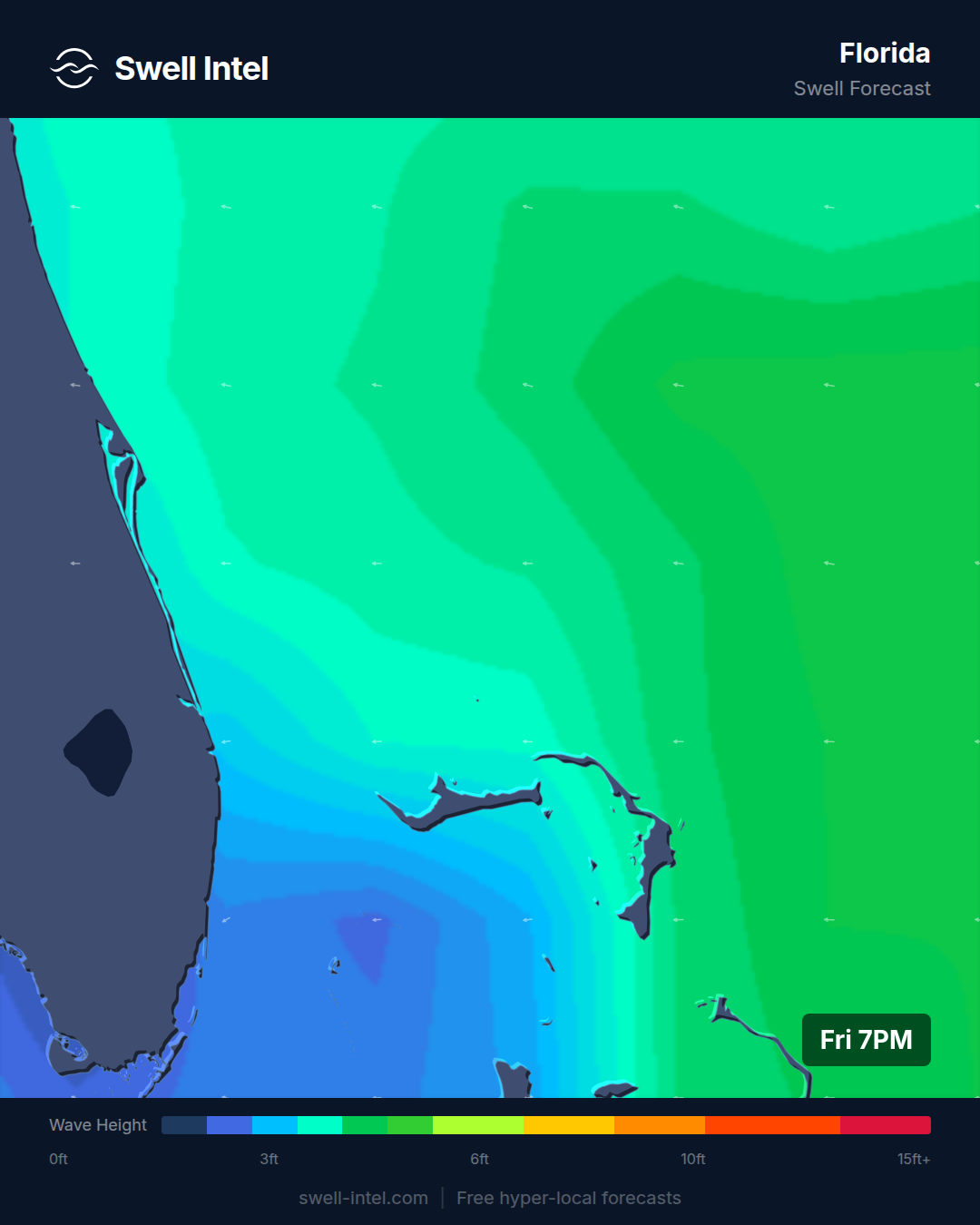
Surf: 1-2ft • Best day: Sunday, Midday • Conditions: Poor-Fair
Florida is quietly one of the more consistent small-wave reads this weekend. An 8-second E swell (83-107°) — a slightly better period than this coast usually sees — has Cocoa Beach, Sebastian Inlet and Jacksonville all hovering around 2ft. Sebastian Inlet is the quality spot whenever there's any swell in the water, and the straight-E angle feeds it directly.
The timing is unusual here: our model favors the Sunday midday window rather than dawn, likely a tide-and-wind alignment lining up better later in the day — so no need for an early wakeup. It's small, but that 8-second period gives it a touch more shape than the typical Florida windslop. Best bets: Sebastian Inlet, Sunday midday.
Puerto Rico
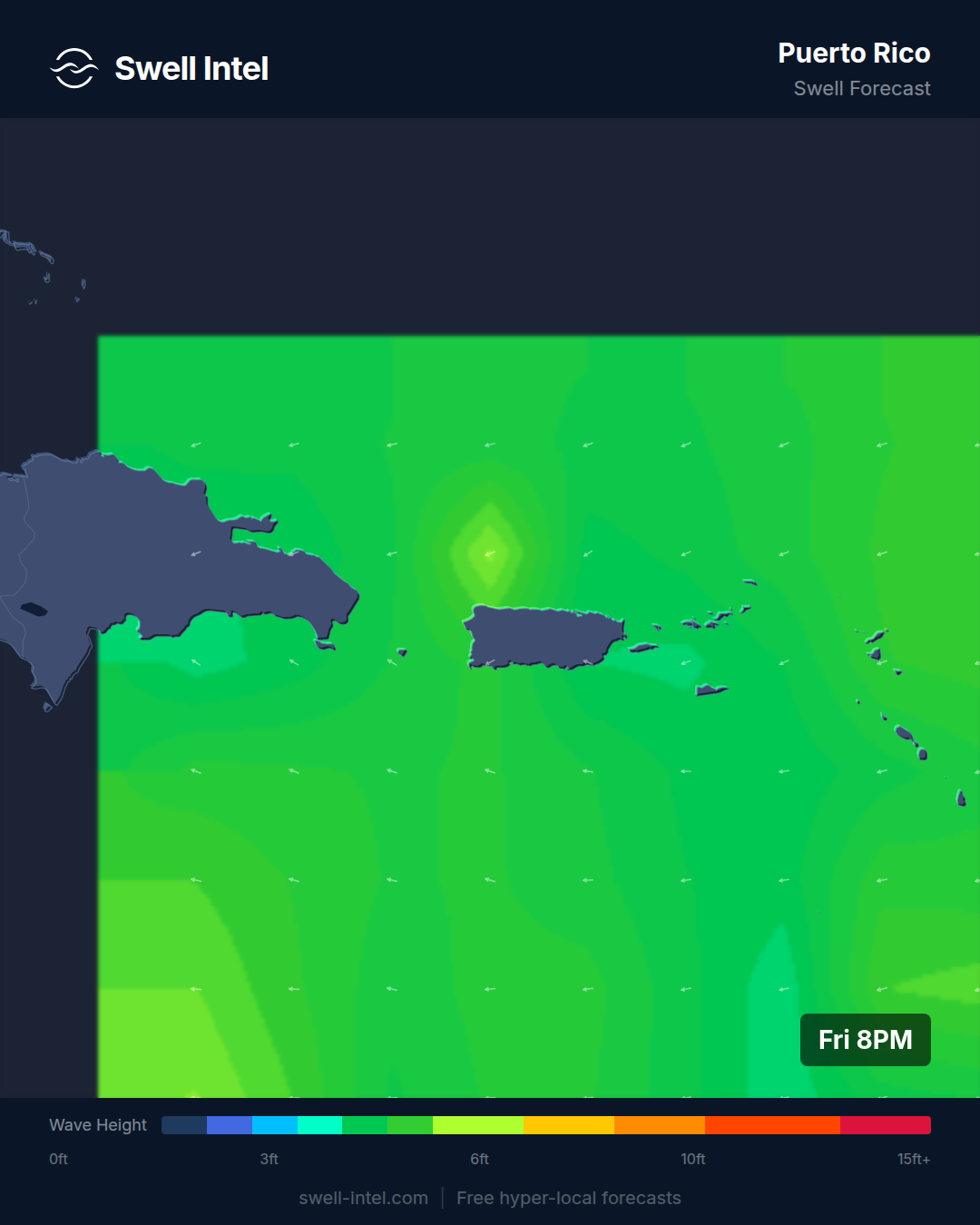
Surf: 0-1ft • Best day: Sunday, AM • Conditions: Poor
I'll be blunt: Puerto Rico is flat this weekend. Wilderness on the northwest coast is scraping 2ft and Rincon's Maria's is 1ft and Very Poor, both running on a weak 7-second ENE swell (55-64°) that has no business producing real surf on a coast built to face N/NW. This is deep off-season — Puerto Rico's engine is winter N/NW groundswell from roughly October through April, and we're nowhere near that yet.
There's nothing to forecast here. Skip it, save the boardbag for winter, and know that when the North Atlantic starts firing this fall, Wilderness will be the first to show it — it typically runs a couple feet bigger than Rincon when the north swell is on. Best bets: none this weekend; wait for the winter season.
Track it live in Swell Intel. These are model calls for the weekend ahead — conditions shift, wind turns, and long-period swells fill on their own schedule. Watch the nearshore forecast update in real time, spot by spot, at swell-intel.com and score the window when it lines up.
📱 Get spot-by-spot forecasts, dawn patrol alerts, and buoy-trained ratings in the SwellIntel app.