
Hurricane Swell Watch: The East Pacific Tropics Wake Up — Here's SoCal's Honest Outlook
Powered by the SwellIntel nearshore SWAN model — with a human tuner keeping one eye on the tropics.
The East Pacific tropics just woke up, and the question is already flying around every group chat in Southern California: is a hurricane swell coming? Here's the honest answer — there's real potential, and there's real reason to keep your stoke in check. Let me walk through exactly what's happening, what could line up for our coast, and why I'm not ready to put numbers on it yet.
Jump to:
- What's actually happening in the tropics
- Why a SoCal hurricane swell is on the table
- Why you should temper expectations
- What our model sees right now
- The call
What's actually happening in the tropics
This is the real deal, not a rumor. As of the National Hurricane Center's latest outlook, a system a few hundred miles south-southwest of southwestern Mexico — tagged EP96 — has a formation chance the NHC puts at "near 100 percent," with a tropical depression or tropical storm expected to organize within a day. That would make it the season's next named storm, likely Elida. The forecast track takes it generally west-northwestward, staying well offshore of the Mexican coast.
There's a second system right behind it, several hundred miles south of Mexico, that the NHC gives roughly a 70 percent chance of developing into a tropical depression by the end of the weekend — a candidate to become Fausto later in the week. (For the record, the other tropical areas on the map are down near Hawaii and are no factor for California.) So the pattern is genuinely active: warm water, a monsoonal setup, and two systems spinning up in a stretch of ocean that, at the right angle, can throw swell straight at us.
Why a SoCal hurricane swell is on the table
Here's the mechanism. A storm forming southwest of Mexico and tracking west-northwestward is, in theory, parked in the one corner of the ocean that can light up our southeast-facing beaches. Hurricane swell reaches SoCal from the south-southeast — roughly the 150-to-180-degree window — and the spots built to catch it are the ones that open to that angle: Newport and The Wedge, which famously stand up on a good southeast pulse, along with the south- and southeast-facing reefs and beaches down through San Diego County. It's a different flavor of summer swell than the Southern Hemisphere groundswell we've been riding — shorter fetch, closer source, and a more easterly angle. (If you want the full breakdown of our summer south swells, that's here.)
Timing-wise, if a storm reaches strength and aims a fetch our way, it doesn't sit far enough out to make you wait long: long-period energy from around a thousand nautical miles covers the distance in roughly two days. That's why the windows people are circling are the coming weekend and again in the middle of the following week — those line up with when a storm peaking over the next several days would actually deliver. In the best-case version of this, Elida becomes a hurricane, holds a fetch pointed at Southern California, and the standout southeast-facers get a fun, long-period session or two.
Why you should temper expectations
Now the part a trustworthy forecast has to say out loud: the best case is not the likely case. Three things all have to go right, and each one is a coin-flip or worse this far out.
- The storm has to actually become a hurricane. Formation is nearly certain; intensity is not. A tropical storm that never ramps up won't move the needle here.
- It has to hold its angle. These systems track west-northwest and can curve away from our swell window as fast as they build. A hurricane pointed at open ocean instead of at us does nothing for your session.
- Distance caps the size. Even a healthy hurricane sitting a thousand-plus miles out delivers a swell that's long-period but attenuated by the time it arrives. This is a "fun, clean, and worth checking" setup far more often than it's a "clear your calendar" one.
And there's a well-documented trap in the long-range guidance: the global models love to over-cook tropical cyclones a week out — inventing storms, over-intensifying them, and wobbling on track — right up until the storm is close enough to read properly. When you see huge surf heights in a long-range app for a system that hasn't even been named yet, that's the model's enthusiasm talking, not a forecast you can drive two hours on. Under-promising here is the whole job: one overhyped skunking costs more trust than a dozen honest calls earn back.
What our model sees right now
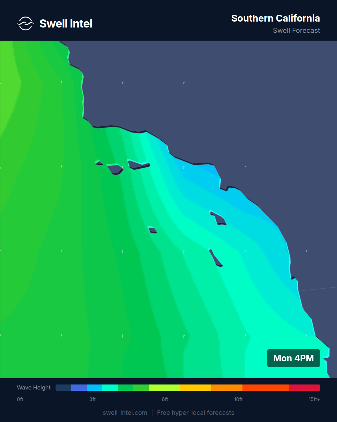
Our nearshore SWAN model runs out about a week, and right now it does not have a big tropical pulse landing on our coast. What it shows for the coming weekend is a modest 2-to-3-foot swell out of the south-southwest at around 13-14 seconds — the tail of our ongoing Southern Hemisphere groundswell, not a hurricane. Trestles and Huntington are the standouts in that read at up to chest-high on the better sets; most everywhere else is smaller. That's the honest present-tense picture.
The hurricane swell, if it comes together, is still out beyond where our 50-meter grid can resolve it — it lives in the global-model outlook, not yet in our nearshore run. That's exactly the handoff point where our model earns its keep: once a tropical swell moves inside about a week out, the model resolves how that southeast angle refracts around the Channel Islands and focuses on specific breaks, and turns the open-ocean storm into a spot-by-spot breaking-wave number you can actually plan around. That's when I'll put a real call on it — not before.
The call
Watch it, don't bank on it. High confidence that a named storm is forming in the right neighborhood; low confidence, this far out, that it delivers meaningful surf to SoCal. Keep the boards waxed and check back midweek — if Elida strengthens and holds its angle, we could be talking about the season's first real hurricane swell around next weekend, and I'll have model numbers for you the moment it's in range. If it curves away or fizzles, you'll hear that from us too. Either way, no hype until the water backs it up.
Track it live in Swell Intel and watch the tropical swell develop at your break in real time — from the open-ocean storm all the way to the wave at the sand.